This Call for Proposals invites proposals for Feasibility Studies and Demonstration Projects for services that combine the use of satellite technologies and robotics for downstream services for transport and logistics.
Pilots and flight operators are benefitting from a new service which combines a variety of space data assets to help them avoid adverse weather conditions. Following a successful ESA Business Applications and Space Solutions (BASS) Demonstration Project, Dutch deep-tech startup Meandair provides meteorological data to support safer flying via an API to flight application developers, and its own standalone applications for mobile devices.
Ensuring the safety of flights when weather conditions are constantly changing is a major challenge for the aviation industry. Safe flight routes need to be planned prior to take-off, after which pilots need to remain constantly aware of any meteorological changes that may affect them as they travel towards their destination. The priority is to be able to navigate around storms or highly convective clouds and avoid landing in heavy rain or icy conditions, and for pilots to be able to make timely decisions about changing their routes if weather conditions worsen.
Having identified an opportunity to address this by using a combination of space services, Meandair undertook an ESA Feasibility Study under the BASS programme in 2018-2019 to explore the viability of a weather nowcasting service for aviation. This was followed by a successful Demonstration Project, also supported by BASS, and in collaboration with Science and Technology and the Royal Netherlands Meteorological Institute (KNMI), that has resulted in a commercially successful data provisioning service, with thousands of unique downloads of the company’s own technology demonstrator mobile application. This has been followed by the development and launch of a virtual airport weather station and a multi-year agreement to provide weather data for leading European general aviation app SkyDemon’s VFR Flyable Conditions feature.
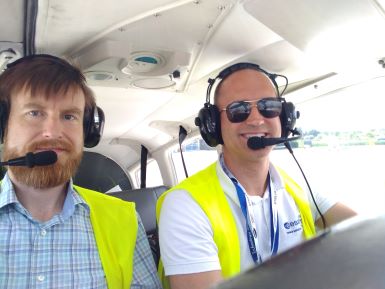
Dr Peter Novak and Arnaud Runge during the test flight
Meandair’s service provides information that can be used by pilots, flight planning personnel and aviation enthusiasts, as well as airports for flight preparation, throughout a flight for flight tracking or even to provide weather-related situational awareness outside the aviation domain. It uses three space assets: satellite communications, positioning information from global navigation satellite systems (GNSS) and Earth observation weather data. GNSS provides the most precise up-to-date position of any plane in flight, allowing this to be matched against the accurate space-time atmospheric model produced by Meandair by aggregating a range of weather information and forecasts, including meteorological satellites. Using satellite data maximises the possible communications coverage at all flight levels. Meandair’s upstream suppliers include the operators of meteorological satellites and national weather institutes and their affiliated organisations, as well as R&D partners providing algorithmic nowcasting scientific expertise.
“Combining the latest near-real-time observations from Earth observations allows us to produce the most accurate and updated nowcasts. This proves essential for timely (operational) decision-making. The aviation domain was definitely the best testing-ground for us in developing this technology. With moving airplanes, rapidly evolving weather and the weather affecting all aspects of operations, this technology would only be used if it met the highest quality standards. We are immensely proud that our weather data now has over 100,000 users world-wide”, says Peter Novák, Managing Director of Meandair B.V.
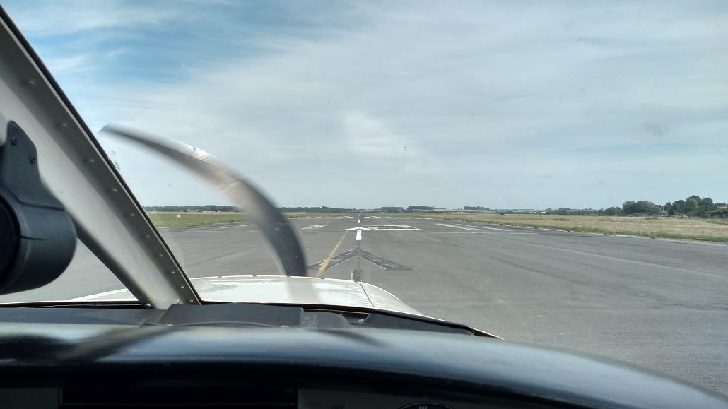
The Demonstration Project started in February 2020, since which time the service has passed both Factory and Site Acceptance Tests. A test flight took place between airports in Rotterdam/The Hague and Valenciennes, France, to verify the readiness of the solution. A range of user trials were also organised between 2019 and 2022, including with ANWB Medical Air Assistance HEMS helicopter pilots whose low-altitude flight missions mean that weather forecasts are particularly important in their planning.
”The ability of space technologies to optimise flight preparation and flight execution and therefore increase flight safety for both general aviation and commercial aviation pilots is truly remarkable. Holding a commercial pilot licence myself, I had the opportunity to try this solution inflight and was really impressed by the benefits it brought” says Arnaud Runge, who led the project for ESA. “In addition, knowledge of weather evolution is a very interesting asset with the potential to make aviation greener by optimising routing to reduce fuel consumption.”
Meandair’s product offering is global, although the focus is primarily on Europe and North America, with thirteen weather products now available within an ever-growing data catalogue. The company now also supplies its products to a range of clients globally, has partnered with US premier provider of connectivity in aviation SmartSky Networks to bring Meandair’s data directly in front of pilots during operation, and has launched its own service AirportWeather.com. Meandair has recently started to supply its weather data outside the aviation domain, serving the renewable energy and live-sports sectors.
Pilots and flight operators are benefitting from a new service which combines a variety of space data assets to help them avoid adverse weather conditions.
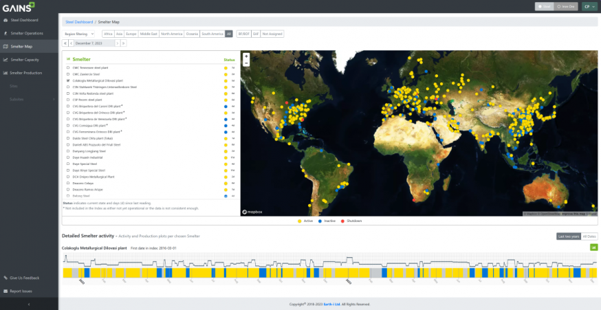
UK satellite and Earth observation specialist Earth-i has successfully delivered an operational system which provides up-to-date information on global supply chains for metals and minerals. The Global Activity Indices from Space (GAINS) project, developed under ESA’s Business Applications and Space Solutions (BASS) programme, focuses on two key areas - global steel smelting operations and movements of iron ore for steel production - and has already gained its first customers, underscoring the sector’s appetite for such a system.
Earth-i’s GAINS service monitors and tracks activity at numerous globally distributed industrial sites to provide high-frequency indicators of activity in complex supply chains, with a focus on sites producing tradeable goods and high-value commodities. Two products were developed as part of the project: a steel smelter activity monitoring service that covers over 95% of known global steel production, and an iron ore stockpiles product focusing on Chinese ports.
Recognising that ground sources can be unreliable and patchy, GAINS uses a mix of very-high, high, medium and low resolution Earth observation data to deliver data-agnostic geospatial insights in a format that is easy for non-technologists to understand and use. The two initial products use different automated methods to process the data, including artificial intelligence, machine learning, spectroscopic analysis and volumetric calculations.
The steel smelter product offers daily monitoring and a continuous dataset dating back to 2016, enabling users to aggregate data by company, country or region, or have custom filters, with options to compare production between different countries or regions. Globally, there are over 1200 sites related to steel production, of which around 800 are operational.
Francesco Feliciani, Head of the Company Led Projects Division at ESA, said “We are pleased to have supported Earth-i in the development of this service which has been well-received by industry, having already been adopted by targeted customers.”
Target markets for GAINS include traders, asset owners, market research companies and regulators. GAINS can provide data down to individual asset performance level or aggregated up to a macro-economic level, depending on the requirements of each trader. Meanwhile, market regulators can use the data to better understand market movements and validate information being reported by industrial operators.
Earth-i launched the live operational GAINS service in May 2023 on a subscription basis. It currently uses optical satellite data of different resolutions from multiple operators, but will later expand to include radar and thermal imaging data, with the programme designed to accommodate other satellite and remote-sensing sources as well as new open source datasets.
Charles Davis, CEO at Earth-i commented “The GAINS service demonstrates the power and scalability of fusing Earth Observation (EO) data and AI to be able to monitor, process and analyse over 1,000 sites dispersed around the globe on a daily basis to a high level of accuracy, and at a low cost. At a time that supply chains are becoming more opaque and more complex, GAINS provides the near-real time transparency our customers require to gain a competitive advantage by being able to validate data 30-90 days ahead of their competition. Earth-i is grateful to ESA and the UK Space Agency for their support to the GAINS project.”
The scalable architecture developed and demonstrated under the BASS project will enable Earth-i to add more product lines in future, such as lead, zinc and other commodities, and extend coverage along entire production chains in specific industries. With scrap steel smelting set to become a major focus in the steel industry, the company is also looking at a scrap steel stockpile monitoring product; the European Union has set a target of 40% of capacity to adopt this approach by 2032. With a transition to electric smelters predicted to result in 80-95% reduction in emissions, Earth-i also has plans to monitor and forecast the pollution caused by steel smelting, to support regulators and authorities to improve the environmental impact of the industry.
UK satellite and Earth observation specialist Earth-i has successfully delivered an operational system which provides up-to-date information on global supply chains for metals and minerals.