Objectives of the service
The PLESS demonstration project aims to further develop Earth Observation-based services and assess their commercial viability for identifying floating marine plastics, in support of reducing the environmental impact of marine litter. The consortium working on the Plastic-Less Society is further developing marine pollution-focused services that combine satellite data and oceanographic models to produce value-added information on marine pollution in the form of plastics. The new developments focus on implementing a super-resolution algorithm to enhance the spatial resolution of Sentinel 2 images, with the ultimate goal of improving the project's services for detecting marine plastics. Additionally, within the project scope, a web platform is being developed where users can request and access the outputs of the PLESS DEMO services autonomously.
Users and their needs
A distinct set of users/customers from different segments has been engaged, contributing to the consolidation of requirements used to tailor the services' development. The most relevant needs identified include:
-
Surveying floating marine debris and supporting plastic collection actions.
-
Monitoring marine plastics in port areas and establishing early warning systems.
-
Supporting the assessment of the environmental state of areas of interest (touristic areas, protected areas, etc.).
-
Assessing the origin and potential destination of floating marine plastics.
-
Identifying areas prone to the accumulation of floating plastics.
The engaged users are from Portugal, Spain, and Argentina, thus covering both sides of the Atlantic Ocean:
-
Cascais Ambiente (https://ambiente.cascais.pt/)
-
Authority Port of Vigo (https://www.apvigo.es/)
-
Fundación Patagonia Natural (https://patagonianatural.org.ar/)"
Service/ system concept
The PLESS demonstration project is being implemented having as reference an EO based marine plastic identification service that GMV has been developing for the last years. The PLESS services will combine satellite data, ground truth data and oceanographic models to produce added-value products for the project users.
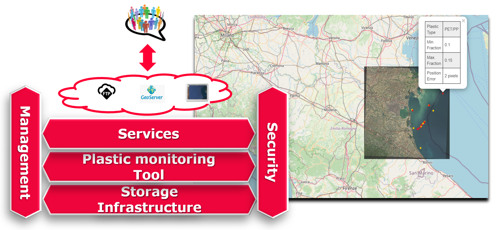
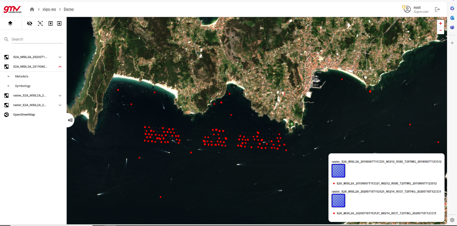
In addition, the PLESS services are being implemented in an online platform (Geobrowser) to which the project users have access to, and that allows them, in a fully autonomous way, to request and get access to the outputs of the project services.
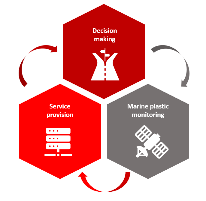
The PLESS services are:
-
Marine Plastic Detection based on satellite data - providing continuous monitoring of floating marine plastics on users’ selected areas of interest.
-
Marine Plastic Tracking based on detection service - providing continuous monitoring of floating marine plastics on users’ selected areas of interest together with ocean circulation models, aiming to understand where plastics are headed and where they can come from.
-
Single order request service - to identify areas prone / not prone for floating marine plastics accumulation
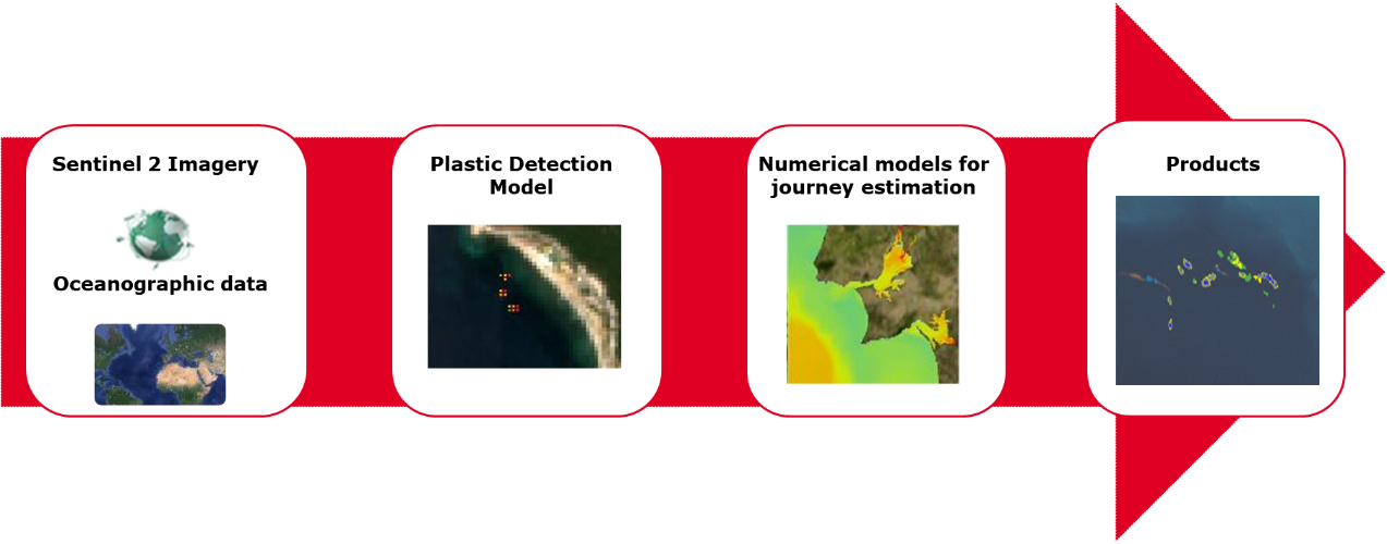
These services are leveraged by a service chain (image below) that has been developed by GMV, which combines various types of data (earth observation imagery, ground truth data, ocean circulation models) to output the location of patches of marine floating plastics.
Space Added Value
This project is running based mainly in Earth Observation images, as they offer a relevant number of benefits:
-
Possibility to generate multispectral compositions from various spectral bands allowing to distinguish the most common types of plastics
-
Possibility of temporal analysis, allows monitoring of changes occurring in the places of interest, as well as the ability to analyse data from the past
-
Digital image processing allows the production and analysis of results in a fast and automated way
-
Reduction of monitoring costs when compared to traditional monitoring methods (e.g. vessel surveys), even more considering that only freely available imagery (Sentinel 2) will be used
Current Status
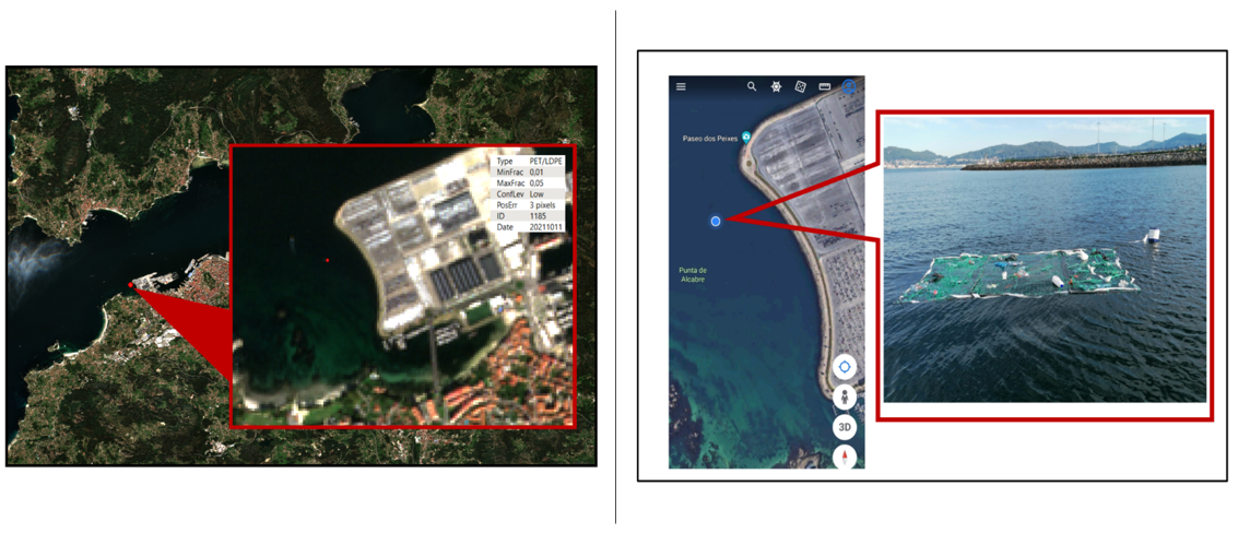
The project has reached the Critical Design Review (CDR) and the initial developments have been leveraged by the lessons learnt during the previous feasibility study, in which a relevant number of activities has been developed, illustrated by the images below (a man-made target that has been built and deployed in the Vigo Port Area, to confirm the service’s ability to detect floating macroplastics).
After the CDR, the consortium is now working on the implementation and configuration of the project’s Geobrowser and the training of the super-resolution algorithm for Sentinel 2 floating macroplastics detection.